
ROBLES DEL RIO / CARMEL VALLEY — October 30, 2026. A publicly available Carmel Valley Fuelbreak Project report contains unusually specific information about wildfire preparation in Robles del Rio. Its interactive project map says crews treated approximately 35 acres in and around the wooded community, including both neighborhood open spaces and participating private parcels. The project also studied a 0.69-mile possible secondary evacuation route for Robles del Rio. The two activities are different: the report describes vegetation treatment carried out, whereas the additional exit was the subject of a feasibility and conceptual design effort, not a verified completed public road.
These details matter because Robles del Rio sits in the hills above Carmel Valley Village, where oak woodland, steep terrain and constrained roads can complicate both wildfire defense and evacuation. This story is based on a documented regional fuelbreak program; it is not a claim that a wildfire is active in Robles del Rio on October 30.
What was done in the 35-acre area?
The project account describes coast live oak woodland and treatment focused on reducing potentially combustible understory vegetation. Crews pruned trees to approximately eight feet where appropriate, removed French broom in selected areas, and reduced downed woody material. The report mentions a combination of mechanical masticators and hand crews, with chipping of cut French broom that had not set seed in some sections.
The mapped project encompassed communal neighborhood spaces as well as private parcels. It does not imply that every Robles del Rio parcel has received a vegetation treatment, that the entire community has a firebreak around it, or that all work occurred in October 2026. The project’s StoryMap describes implementation but does not give a reliable new completion date for every parcel. Residents should request current maintenance schedules rather than treat an undated photograph as present-day field activity.
Why French broom is a particular concern
French broom (Genista monspessulana) can form dense stands and contribute to hazardous fine fuels, while its seeds create ongoing management challenges. The project expressly identifies reducing invasive-plant spread as a goal. Carefully choosing when and how to remove broom may help limit seed spread; simply disturbing large patches without follow-up can lead to renewed growth. The report also notes that treatment must consider soil stability and habitat, so cutting all vegetation to bare ground is not the objective.
What does the 0.69-mile exit figure mean?
Under its Secondary Evacuation Routes section, the project lists Robles del Rio: 0.69 miles and Carmel Views: 0.56 miles. It describes an engineering feasibility assessment and conceptual cost estimates for possible alternative exit routes serving vulnerable neighborhoods. The conceptual documents are not a government notice that new roads are open to residents or visitors. A route cannot be treated as a legally public or safely passable evacuation corridor without confirmed right-of-way, necessary approvals, construction and official designation.
The distinction is important: a line shown on a planning map may involve sensitive terrain or private property. Residents must follow existing officially identified evacuation routes and emergency instructions rather than attempt to drive a future conceptual alignment.
How this differs from flood preparedness
California58 previously reported on the severe 1995 flood history and on river-gauge monitoring. Fire fuel reduction addresses a different hazard from the movement of floodwater, although steep hills and limited road access can complicate emergency responses in both situations.
When officials call for evacuation, Alert Monterey County provides authoritative county warning information. Residents can make a household emergency plan, identify where vehicles and animals can be taken, check their address-specific evacuation zone, and sign up for notices. Neither cleared vegetation nor an exit feasibility study guarantees that an individual home is fireproof.
What still needs to be confirmed
The project documents do not provide a verified date for the next fuel-maintenance round, identify the ownership status of every mapped parcel, or show a final approved construction contract for the 0.69-mile secondary exit. Those are questions for local fire authorities, county public works, landowners and project administrators. Avoid assuming land-management work and an actual new road are a single finished project.
Primary source
Carmel Valley Fuelbreak Project — interactive StoryMap, Robles del Rio 35-acre treatment area and proposed 0.69-mile secondary evacuation route; Alert Monterey County — current evacuation notices. Reviewed October 30, 2026. Site-specific project chronology and new-road completion are not asserted without separate documentation.
Send verifiable project records or corrections to California58 Newsroom.
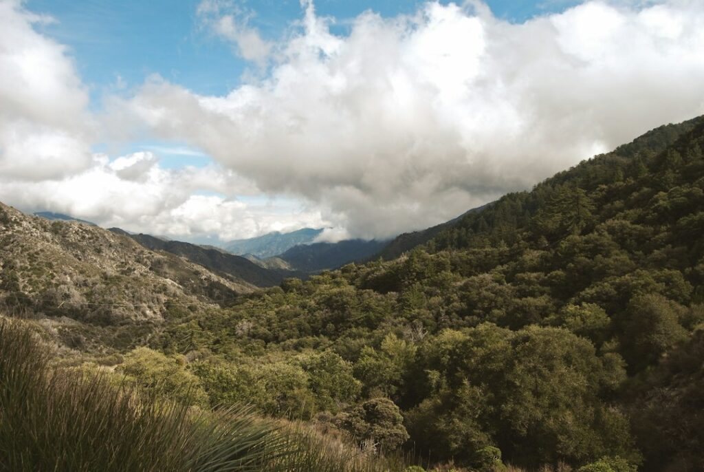
Featured photo: illustrative Southern California woodland by James Horrox / Unsplash. This is not the Robles del Rio vegetation-treatment area or its conceptual secondary evacuation route.
Help this community newspaper grow
Your support helps build coverage for the people and places this local newspaper serves.
Donate once by card ↗Support Robles del Rio News
Choose how to support Robles del Rio News:
Credit / Debit Card via StripeChoose an amount from $1. One-time support through the publisher's LINKERNO Stripe account.
Continue with PayPal Continue with ZelleZelle payments go to Vitaly Ataev Troshin. Please verify the recipient in your bank before sending. Availability depends on your bank.
Optional reader support. When possible, add “Robles del Rio News” to the payment note. Contributions are not advertised as tax-deductible. Support does not influence editorial decisions.More from Robles del Rio News
- Robles del Rio Flood History: County Records 80 Homes Damaged in March 1995 and Explains Carmel River Risk →
- Robles del Rio Residents Can Track Carmel River Flood Stages at NOAA’s RDRC1 Gauge →
COMMUNITY
Comments
Join the California58 conversation. You must be signed in to comment.
Create a free California58 account or sign in with an available social provider.